Discover and Protect Heritage from a New Perspective
Chronos AI applies advanced computer vision to satellite, aerial, and LiDAR data to automatically detect potential archaeological features and monitor the health of our shared cultural landscapes across inaccessible terrain.
Analyze Your Survey Area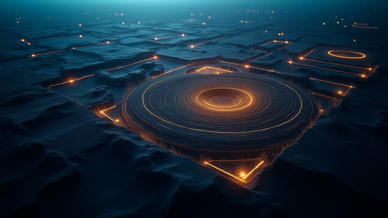
Our Remote Sensing Capabilities
Bridging the gap between orbital technology and ground-level history.
Automated Site Discovery
Our models scan thousands of square kilometers of multi-spectral imagery to flag anomalies consistent with archaeological features such as enclosures, mounds, and ancient field systems.
LiDAR Data Processing
We filter digital elevation models (DEMs) derived from LiDAR to remove dense vegetation canopy, revealing subtle topographic features and earthworks invisible to the naked eye.
Change Detection & Monitoring
By comparing historical and recent imagery, our AI automatically flags changes indicating looting pits, urban encroachment, or environmental erosion at protected heritage sites.
Risk Assessment Mapping
We integrate multi-source environmental and human activity data to create predictive risk maps, helping conservationists prioritize intervention for vulnerable cultural heritage.
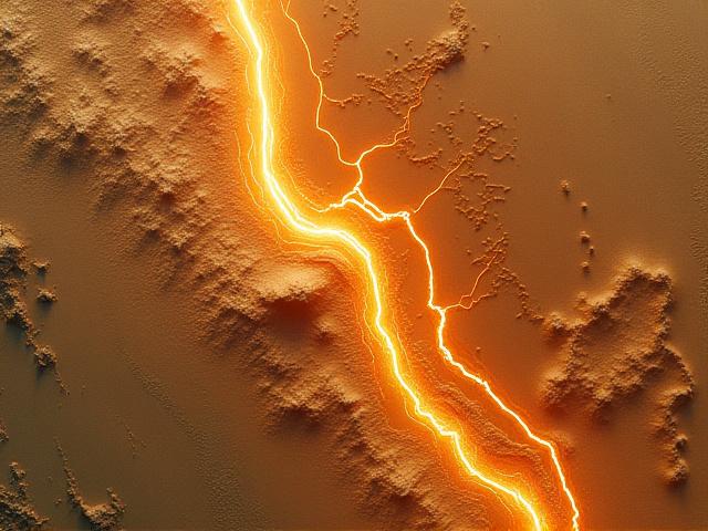
Identifying Ancient Irrigation Systems in Peru
In the arid regions of coastal Peru, pre-Columbian irrigation canals are vital records of ancient engineering, yet they remain largely invisible from ground level due to sediment and vast terrain. By processing 10,000 sq km of high-resolution satellite and SRTM topographical data, Chronos AI identified a sprawling network of 74 km of previously unmapped canals.
- Detected 74 km of ancient canal infrastructure.
- Discovered 12 associated small settlement sites through proximity analysis.
Data Sources We Process
Satellite Imagery
Maxar, Planet, Sentinel-2
Aerial Photography
Historical & Modern archives
LiDAR Data
Airborne & Terrestrial DEMs
Drone/UAV Data
Photogrammetry & Spectral
See Your Landscape in a New Light
Whether for discovery, academic research, or urgent preservation, our remote analysis provides the critical data-driven insights needed to manage heritage at scale.
Analyze Your Survey Area