The Archaeologist's AI Toolkit.
From artifact classification to site discovery, we provide AI-powered tools that enhance, not replace, archaeological expertise. Spend less time sorting and more time uncovering the narratives of the past.
Secure Field Access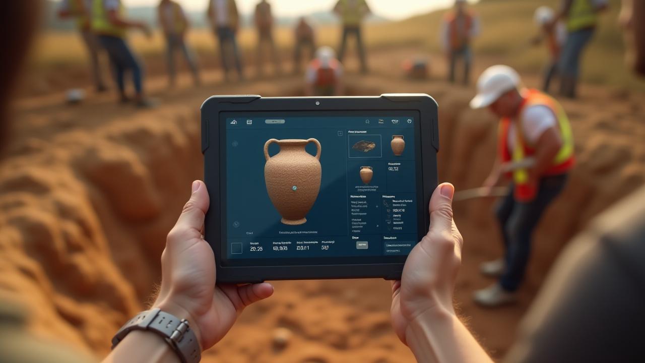
How AI Can Assist Your Project
Automated Pottery Classification
Train a model on your project's unique typology to rapidly sort thousands of sherds by form, fabric, and decoration with machine precision.
Lithic Analysis Assistance
Utilize advanced computer vision to perform initial measurements and morphological classifications on stone tool assemblages automatically.
Site-Wide Spatial Analysis
Ingest point-provenience data to create multi-dimensional density maps and identify hidden patterns in artifact distribution across features.
Remote Sensing for Discovery
Analyze satellite or LiDAR imagery to identify subtle anomalies that indicate buried structures. Learn More →
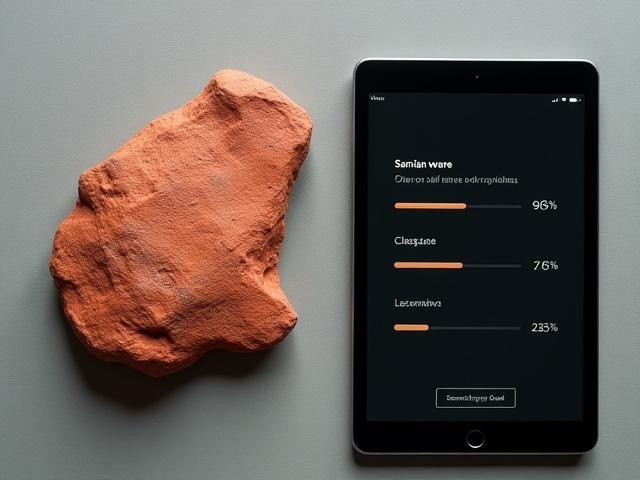
In the Field: Classifying Roman Samian Ware
The Challenge
A single excavation season produced over 50,000 sherds of Samian ware, a highly standardized Roman pottery. Manual sorting threatened to consume the research budget and timeline.
The Solution
We trained a computer vision model on a reference collection of 2,000 verified images and deployed the system on-site via portable tablets for immediate results.
The Result
Reduced initial sorting time by 70%, allowing specialists to focus on high-priority finds and broader site interpretation. Accurate top-3 identification provided confidence scores for every sherd.
Visualizing Stratigraphy and Site Data
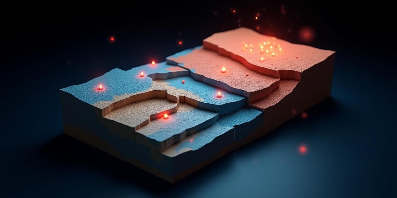
Go Beyond the Harris Matrix
We help digitize your context sheets and stratigraphic drawings into living data. Our tools generate high-fidelity 3D models of your excavation, allowing you to visualize layers and artifact distributions in a fully interactive spatial environment.
- Identify spatial inconsistencies instantly.
- Correlate finds with specific soil matrices.
- Generate automated volumetric reports.
Integrates with Your Digital Workflow
Chronos AI systems are designed to support your work, not replace your tools. We ensure full interoperability with the software you already trust.
All analytical outputs can be exported as CSV, JSON, or shapefiles for seamless integration into QGIS, ArcGIS, and standard database systems.
Institutional API Access
For large scale research institutions, we offer direct API access to integrate our neural networks directly into your custom collection management software.
Digitize and Accelerate Your Excavation
See how our intelligent assistance can fit into your next field season or post-excavation analysis phase.
Book a Demo for Your Team